Climate Change Affects Sea Ice Formation in North Water Polynya
Satellite photo showing North Water Polynya in May 2020.
Crédit : Oceans North
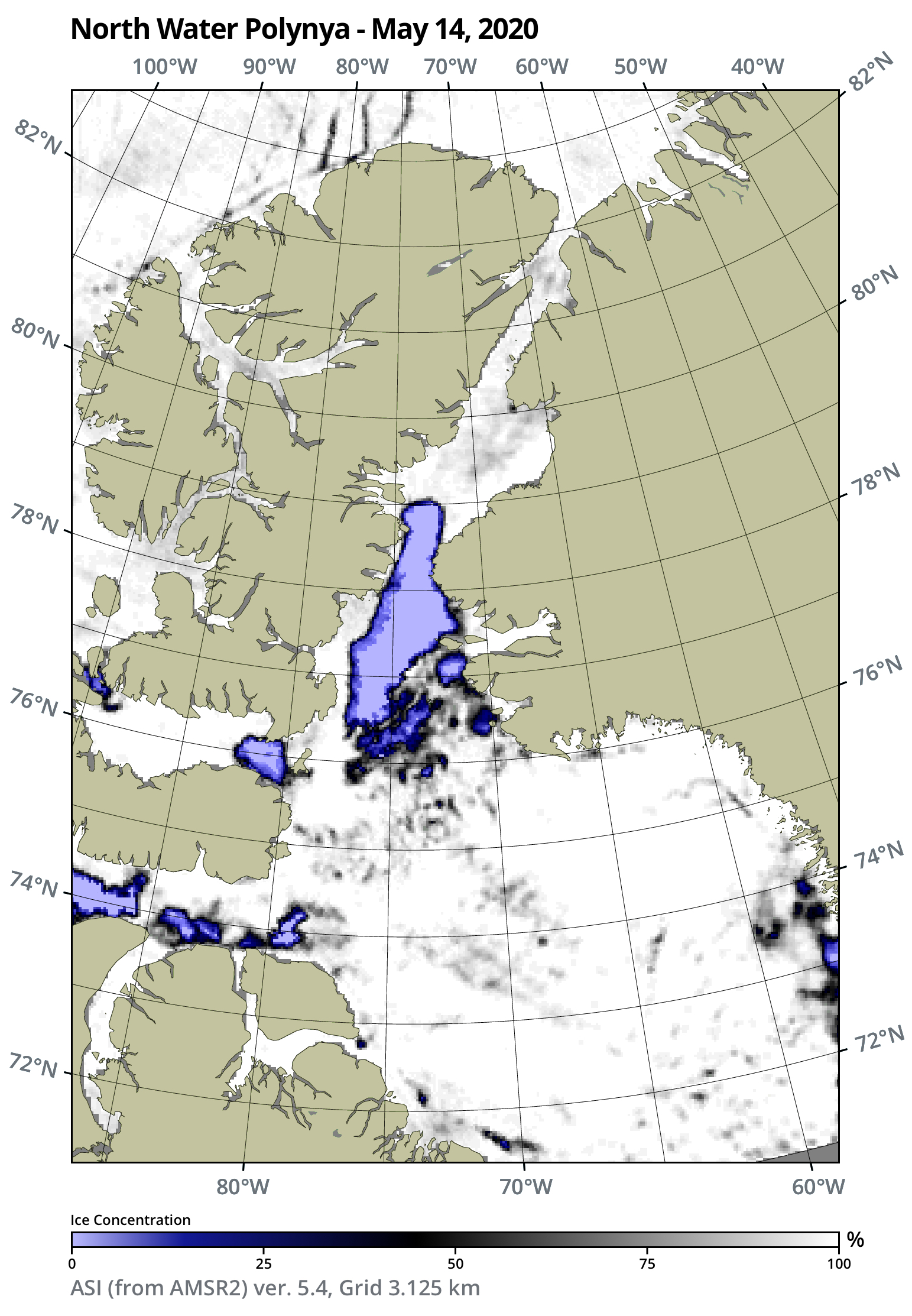
Pikialasorsuaq, also known as the North Water Polynya, is a biologically rich area of open water surrounded by sea ice that forms each winter between Ellesmere Island and Northwestern Greenland. This polynya is created when an ice bridge, also known as an ice arch, builds up in Nares Strait, preventing High Arctic sea ice from moving south towards Baffin Bay. Even though there is considerable annual variation about when and where the ice bridge forms, climate change has impacted its life span, shape and stability. Over the last forty years, the number of days the ice bridge has existed each winter has decreased by an average of 2.1 days annually – or a total of 84 days.
One way to understand these changing ice conditions is to examine trends over time. Oceans North has collaborated with Bremen University in Germany to obtain satellite images that track the sea ice coverage in the Pikialasorsuaq region. We’ve uploaded these images to our website to provide weekly snapshots of the polynya beginning in April 2020. By clicking through them, you can observe where and when the ice bridge in Nares Strait forms. Once that occurs, wind and ocean currents shift the ice south towards Baffin Bay opening up the polynya. Deep, warm Atlantic waters well up to maintain an almost ice-free zone in Smith Sound. As spring arrives, the polynya expands southward until June or July when both the ice bridge and polynya break down.
For example, during the past winter, sea ice slowly filled the zone between the Lincoln Sea and Nares Strait in December 2019, creating the ice bridge. The polynya was visible by early January and expanded to its maximum size by mid-May. By early July, the ice bridge began to break down, making it an average year overall.
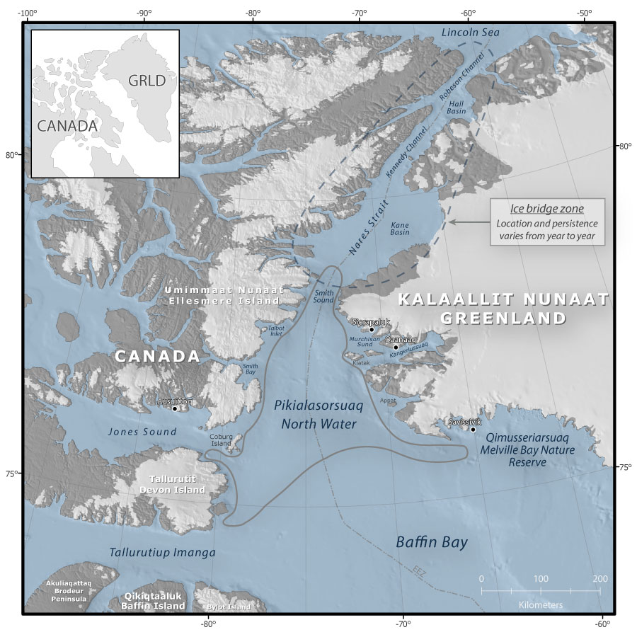
The North Water Polynyna forms each winter between Nunavut and Greenland.
Crédit : Oceans North
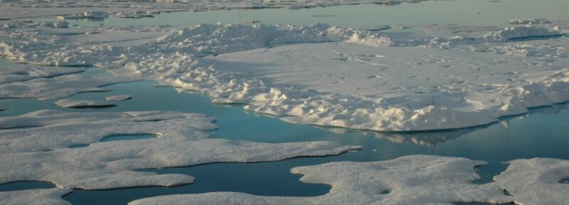
The ice bridge is fundamental to the formation of this biologically productive polynya. Marine mammals, such as beluga, narwhal and walrus, seabirds, as well as fish like Arctic Char and Greenland halibut, depend on the polynya for vital summer and winter habitat. The early spring bloom is triggered by light penetrating the open waters of the polynya and activating the growth of phytoplankton, the base of the food web. Many species in the North Water region rely on this robust phytoplankton bloom that supports a continuous source of nutrients in the water column throughout the rest of the year. Researchers are studying how the variation in the formation of the ice bridge may impact productivity of the polynya. And local communities are worried about the potential risks to wildlife and fish that provide essential sources of food. In 2017, the Pikialasorsuaq Commission released a report recommending conservation efforts to protect this region.
The ice bridge in Nares Strait has long been of importance to Inuit in both Nunavut and Greenland. Community members of this region have traveled across the sea ice bridge to visit relatives in Canada and Greenland. The potential loss of this historic route is of concern to these communities.
Zoom in and take a look at the satellite maps. What do you see? The difference between each image may be subtle, but over time, they tell a story about this dynamic environment. So much is unknown about how changing sea ice conditions will affect the polynya. More research is needed, both locally and bi-nationally, to determine how the stresses of climate change will affect Pikialasorsuaq.
Ann Eastwood is a field scientist with Oceans North and is based in Winnipeg.
Related Content

A snapshot of the polynya on May 8, 2024, per NASA Worldview.
Crédit : Terra/MODIS
Northern Latitudes: Mapping the North Water Polynya
A seemingly endless landscape of ice, sea, and meltwater in the Arctic Ocean's Canada Basin.
Crédit : Jeremy Potter NOAA/OAR/OER
Introducing Northern Latitudes: A Series on Maps and Mapmaking

Crédit : Oceans North
Agreement Between Canada and Greenland Marks Major Step Forward for Protection of Shared Arctic Ecosystem
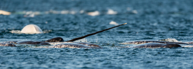
Narwhal breach the surface in the North Water. Narwhal, along with other marine mammals, use this area for calving, foraging, and migration.
Crédit : Adobe Stock