Each spring since 2016, Oceans North has installed two time-lapse cameras on Mount Herodier above Tasiujaq (formerly Eclipse Sound), Nunavut, to monitor sea ice conditions before, during and after breakup.
How the Cameras Work
The time-lapse cameras capture images of the floe edge and Tasiujaq every two hours.
Each camera system consists of a weather-proof box that houses the cameras, time-lapse controllers and high-capacity batteries, all of which are charged and powered by 20-watt solar panels.
The cameras transmit images to the Oceans North server over a cellular network via USB cellular sticks. This allows images to be shared in near real-time with the community of Pond Inlet, researchers and Arctic enthusiasts. Photos are posted on this webpage as well as a touch screen at the Nattinak Visitors Centre in Pond Inlet. Our project is conducted with the help of hunters and others from Pond Inlet and is permitted under the Nunavut Research Institute.
Working in this remote region presents challenges. The camera equipment must withstand harsh weather conditions that can cause the lenses to ice up, and image transfers are occasionally incomplete or lost due to inconsistent cellular connectivity. Unfortunately the installation site is too remote to allow for regular maintenance of the systems, apart from visits in the spring and fall.
Camera Positions
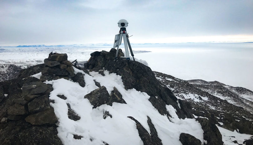
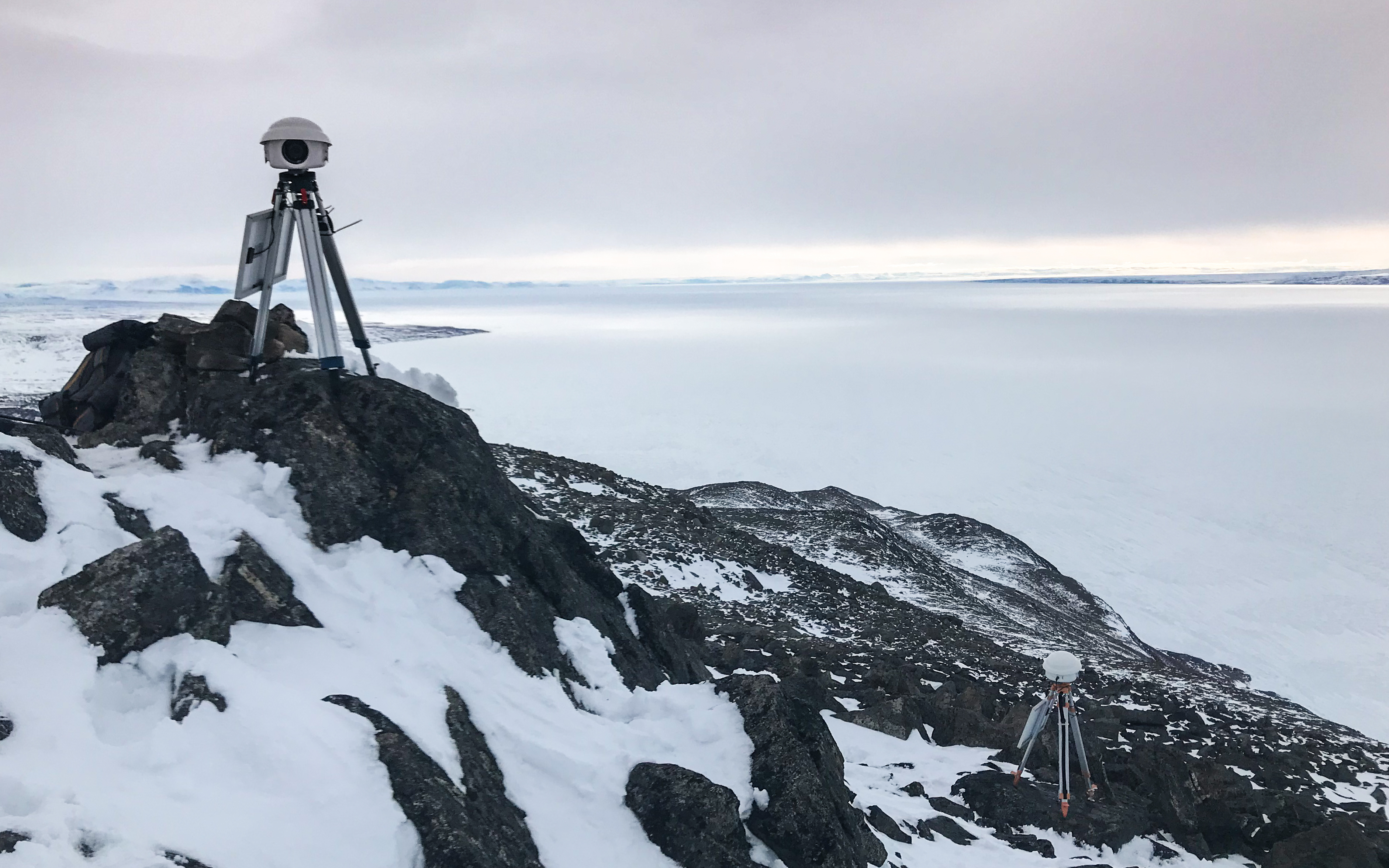
The two cameras, seen here positioned atop Mount Herodier, point toward Tasiujaq to the west and the floe edge to the east.
Two time-lapse cameras are installed on Mount Herodier, one overlooking Tasiujaq and the other the floe edge. The camera housings are mounted on sturdy tripods, which are anchored in place to withstand the extremely windy and harsh conditions.
Credit: Patricia Chambers
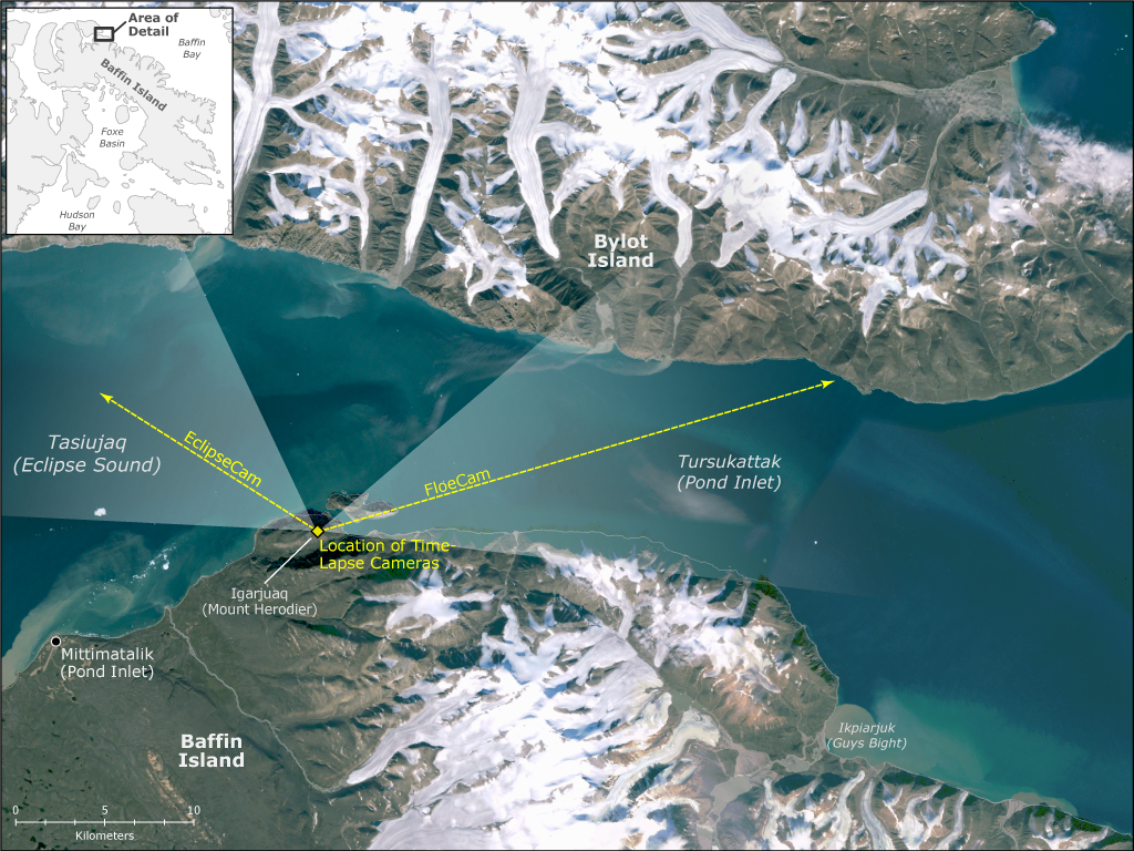
This birds-eye view shows the cameras’ positions and fields of view with respect to the surrounding landscape.
The time-lapse cameras are located near the summit of Mount Herodier, roughly 17 kilometres west of Mittimatalik (Pond Inlet). One camera points to the east toward the floe edge, and the other is oriented WNW, overlooking the eastern end of Eclipse Sound. The yellow arrows and semi-transparent white triangles on the map show the cameras’ orientations and fields of view. (Landsat imagery courtesy of Natural Resources Canada)
Credit: Oceans North
Installing the Cameras
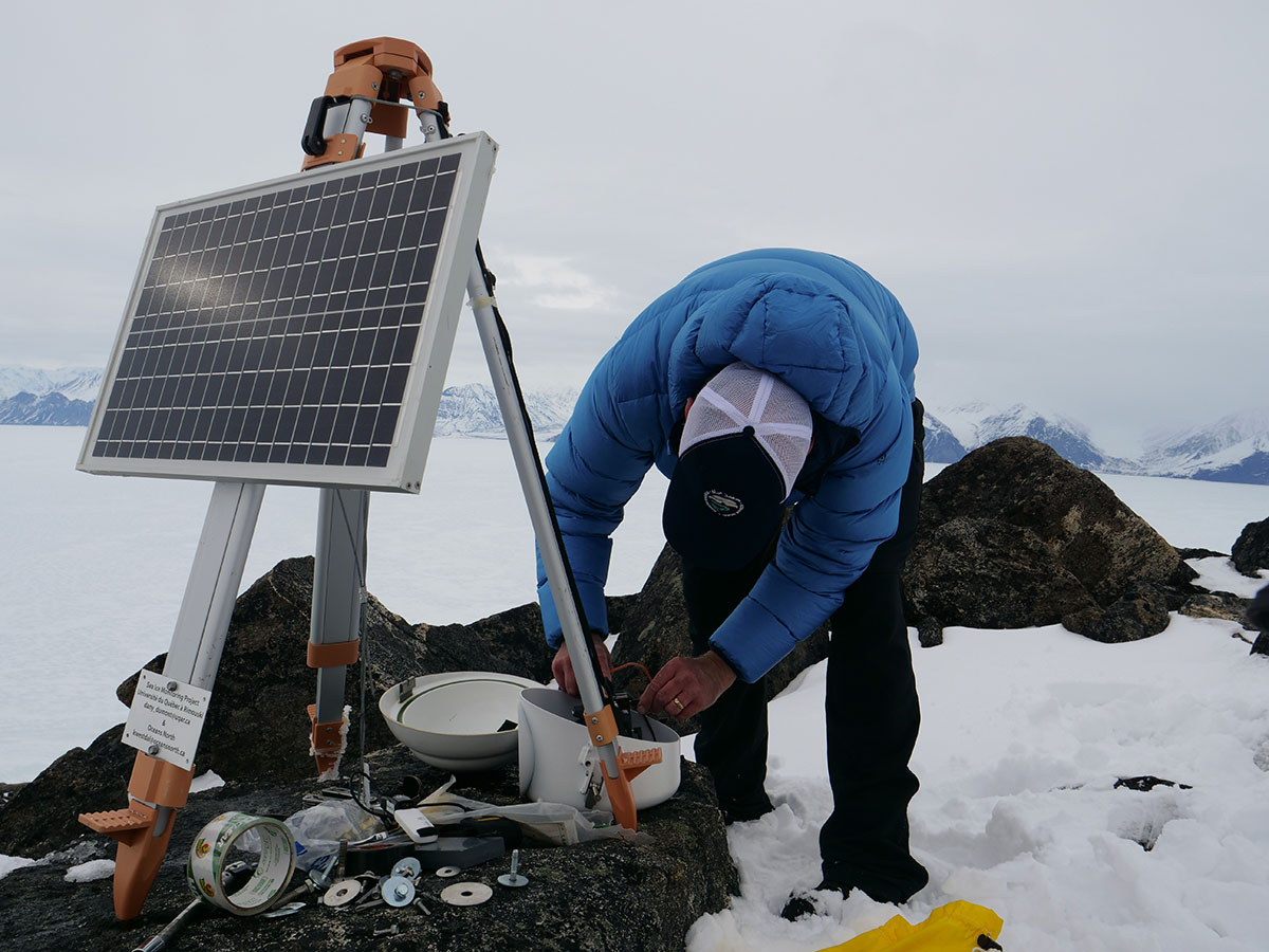
Our team transports the equipment to the sites by snowmobile and on foot in late May or early June. In the fall, the cameras are usually retrieved by boat and foot. In 2018, the cameras will be left out over the winter with the hope of capturing the formation of landfast ice. The equipment will shut down when the Arctic days become too short to recharge the batteries.
Installing the cameras requires a lot of fine-tuning to get everything set up correctly. The 20W solar panels mounted on each tripod will keep the systems charged through summer and into the fall.
Credit: Patricia Chambers
For a detailed story about our installation trip in 2018, visit our blog post.
Our Research Partners
This research is being conducted in collaboration with Dr. Dany Dumont of the Université du Québec à Rimouski. Dumont’s team at Institut des sciences de la mer de Rimouski (ISMER) plans to use the images in conjunction with satellite and environmental data to study the breakup of landfast ice in the area. Over time, they hope to use this information to accurately predict ice breakup in the region, as well as farther north. Results will be shared with the community as they become available.
Clear-Day Views from Each Camera
View from the Eclipse Sound-facing camera on a clear day (June 14, 2018).
Credit: EclipseCam/Oceans North
View from the floe edge-facing camera on a clear day (June 11, 2018).
Credit: Oceans North