How Drones Can Help Nova Scotia Communities Adapt to Climate Change
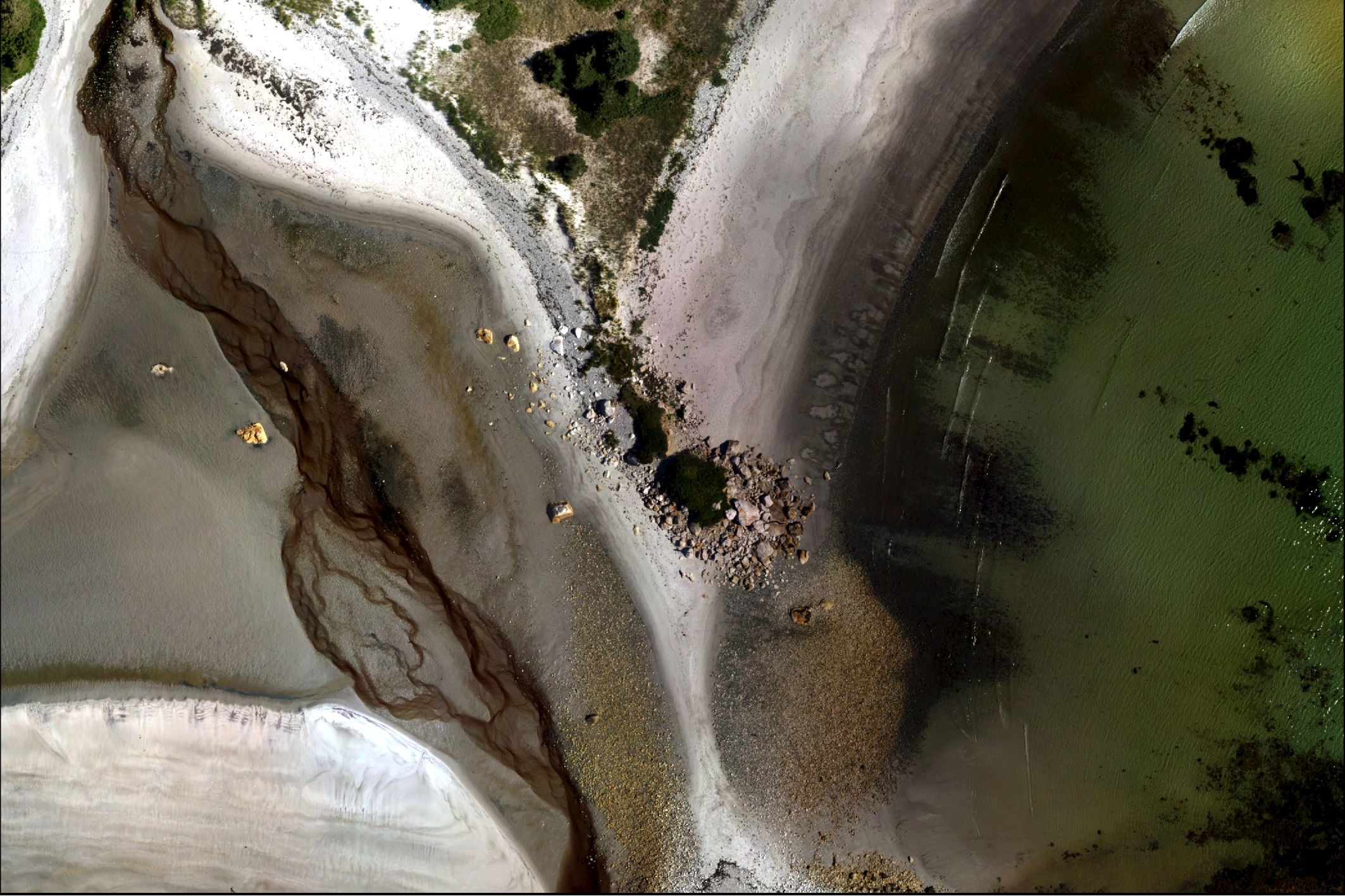
Part of Thomas Raddall Provincial Park, displayed in 2D using aerial imagery collected by the drone.
Ilitariyauyuq: Maxime Lapierre, MAPVisLab
Many people associate drones with breath-taking photography—a camera slowly panning over an impressive mountain vista, or zooming in close on a raft of hunting sea lions. However, drones can provide much more than just stunning pictures.
Originally designed for military operations, rapid advances in technology and a booming commercial and recreational market have improved drone performance and lowered costs over the past decade. Operating a drone is both cheaper and easier than using a helicopter or plane, and their manoeuvrability enables them to get right into the action. In our oceans, scientists are now using drones to monitor wildlife populations, identify coastal hazards, detect marine litter and much more.
As part of the Marine Affairs Program at Dalhousie University and with the support of Oceans North, I decided to look at how 2D and 3D maps created by drones can be useful for Nova Scotia’s coastal communities. Nova Scotia’s low coastline is particularly vulnerable to the impacts of human-induced climate change, including sea level rise and more frequent, intense storms. These impacts are set to get worse, so exploring cost-effective adaptation measures is of the utmost importance. By creating maps, I wanted to see if they could help people better understand and visualize the threats that our coastline is facing, as well as help identify current and future issues.
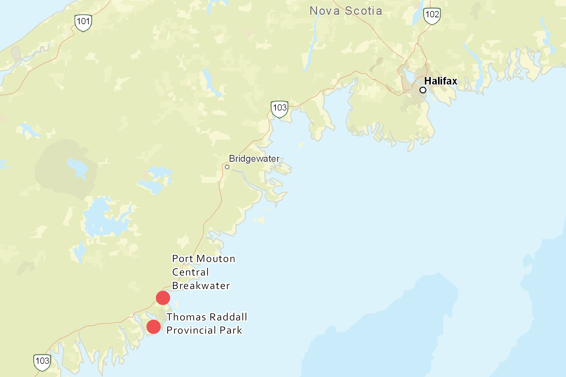
Two sites were selected for mapping in Queens County, a region of diverse coastal ecosystems and communities engaged with conservation and climate change adaptation. The sites represent very different coastal environments—one is a working wharf, and the other a sandy beach in a provincial park. In July, we used a drone to collect aerial imagery of both sites. The images were processed to create 3D maps, examples of which can be viewed on ArcGIS online (the wharf and the beach).
The locations of the two sites flown over with the drone.
Ilitariyauyuq: Reanne Harvey
Using the maps, I carried out nine interviews with community members, government employees and environmental non-governmental organizations. It became apparent from the interviews that the drone maps helped to clarify the suspected impacts of climate change for the participants, as well as provide a more holistic perspective of the environment. Viewers were able to gauge several physical characteristics, including the elevation, the topography of the landscape (or the height of the wharf), the vegetation, the sediment type, the composition and state of structures, the high tide mark and the current wave trajectory.
Besides increasing public awareness of climate change impacts, the interviews also revealed other uses for the maps of coastal Nova Scotia. These include using maps created by drones to model flood risk and projected sea level rise along the coast, as well as identifying vulnerable coastal infrastructure and areas of risk for new developments.
Once at-risk areas are identified, drones can help communities find ways to adapt. For example, one way of mitigating the impacts on these vulnerable areas is through “soft engineering,” such as coastal restoration. One organisation operating out of Bridgewater, Nova Scotia is working on creating “living shorelines,” where areas are revegetated to help prevent coastal erosion. For this project, the drone maps offer potential for improved site assessments to determine the type and quantity of vegetation required, as well as consistent monitoring and evaluation of the revegetation’s effectiveness.
However, drones are not without their limitations. Bad weather and site access can impede flights, and as of June 1st, 2019, Transport Canada has placed greater restrictions on the use of drones. Most of these limitations can, however, be overcome with thorough pre-flight planning.
As I wrap up my project and reflect on what I have learnt, a few things stick out to me. I have seen firsthand how easy it can be to create beautiful 2D and 3D maps of coastal regions using drones. Maps such as these can help people visualize the coastal impacts of climate change—most of the people I interviewed felt more connected to the sites, as they could picture themselves walking along the beach or wharf. The maps can also be used by scientists and different levels of government to quantify these impacts and make better management decisions moving forward: which wharfs will need reinforcing, which developments may be risky, and more.
Given the rate at which the impacts of climate change are being observed, it seems prudent to continue exploring the uses of drones. Affordable, easy to operate, and able to produce detailed maps, drones have great potential to help coastal communities as they adapt to a changing climate.
Related Content

A snapshot of the polynya on May 8, 2024, per NASA Worldview.
Ilitariyauyuq: Terra/MODIS
Northern Latitudes: Mapping the North Water Polynya
Ilitariyauyuq: Oceans North
New Report Highlights the Seascape at the Heart of Canada
Greenland halibut air drying.
Northern Latitudes: Where Do Greenland Halibut Live in Canada’s Arctic?
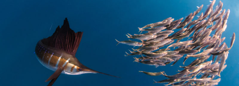
Top predators like the sailfish are disproportionately vulnerable to climate impacts, according to a new study.
Ilitariyauyuq: Peter Allinson, MD / Marine Photobank via Wildscreen Exchange